How can I improve the altitude accuracy in TwoNav GPS?
Content
Preamble
Since the beginning of 2021, IGN has been providing free access to some of its data:
- IGN's TOP 25 maps are not free yet, however the Map version available on Géoportail is free.
- Databases of the IGN altimeter 5 x 5 m are freely available. These databases allow the creation of a digital terrain model, i.e. a height map with a horizontal resolution of 5 mx 5 m or 1 mx 1 m with a vertical resolution of 1 m. Or a great definition for the users that we are.
This article in tutorial form is intended more specifically for users of GPS TwoNav and Land software.
It is not possible to influence Garmin GPS altitude data at this time.
What is a digital elevation model (DTM)
A digital elevation model (DEM) is a three-dimensional representation of the earth's surface created from elevation data. The accuracy of the elevation file (DEM) depends on:
- The quality of the altitude data (accuracy and means used for surveying),
- Unit cell size (pixel),
- About the horizontal accuracy of the localization of these grids,
- The accuracy of your geolocation and therefore the quality of your GPS, connected watch or your smartphone.
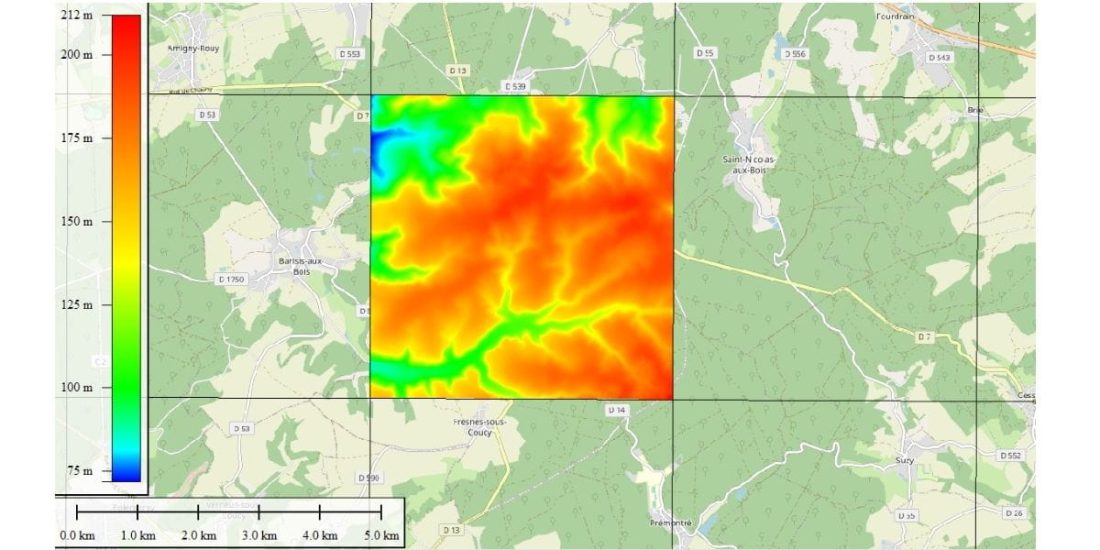 A slab or tile from the IGN Altimetric database. 5 km x 5 km tile, consisting of 1000 × 1000 cells or 5 mx 5 m cells (Saint Gobain Aisne Forest). This screen is projected onto the OSM basemap.
DEM is a file that defines the height value of a point located in the center of the grid, with the entire surface of the grid at the same height.
For example, a 5 x 5 m Aisne BD Alti IGN department file (department chosen because of its large size) is just under 400 tiles.
Each grid is identified by a set of latitude and longitude coordinates.
The smaller the grid size, the more accurate the elevation data. Elevation details smaller than the mesh size (resolution) are ignored.
The smaller the mesh size, the higher the precision, but the larger the file will be, so it will take up more memory space and harder to process, potentially slowing down other processing operations.
The DEM file size for a department is about 1Mo for 25m x 25m, 120Mo for 5m x 5m.
The DEMs used by most apps, websites, GPS and consumer smartphones are from free global data provided by NASA.
The order of accuracy of a NASA DEM is a cell size of 60m x 90m and a step height of 30m. These are raw files, they have not been corrected, and often the data is interpolated, the accuracy is average, there may be large errors.
This is one of the reasons for the vertical inaccuracy of GPS, which explains the difference in altitude observed for the track, depending on the website it is hosted on, the GPS or smartphone that recorded the difference in altitude.
- The Sonny MNT (see later in this guide) is available free of charge for Europe with a cell size of approximately 25m x 30m. It uses more accurate data sources than NASA MNT and has worked to address major bugs. It is a relatively accurate DEM suitable for mountain biking, with good performance across a European country.
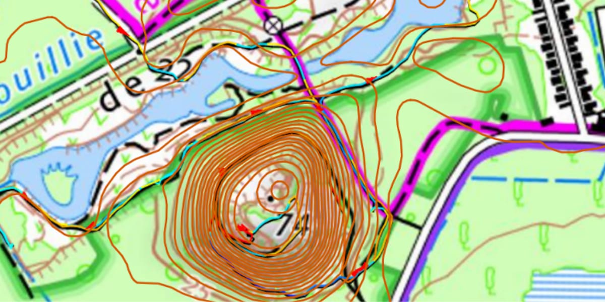 In the image above, the altimetric tile (MNT BD Alti IGN 5 x 5) covering the slag heaps (near Valenciennes) has been converted to contour lines spaced 2,5 m apart and superimposed on the IGN map. The image allows you to "convince" of the quality of this DEM.
- The 5 x 5 m IGN DEM has a horizontal resolution (cell size) of 5 x 5 m and a vertical resolution of 1 m. This DEM provides the terrain elevation; the height of infrastructure objects (buildings, bridges, hedges, etc.) is not taken into account. In the forest, this is the height of the earth at the foot of the trees, the surface of the water is the surface of the coast for all reservoirs larger than one hectare.
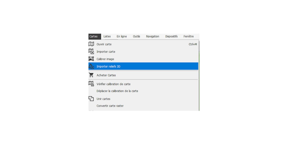
Assembly and installation of DEM
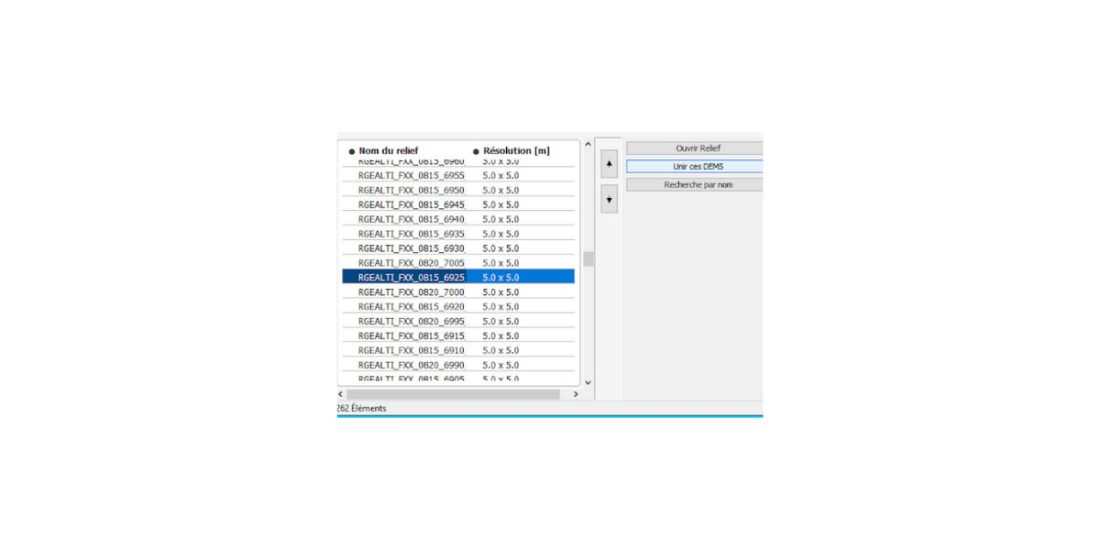
To move faster: A TwoNav GPS user has compiled a digital terrain model covering France using 5 x 5 m IGN data. These can be downloaded by region from the free site: CDEM 5 m (RGEALTI).
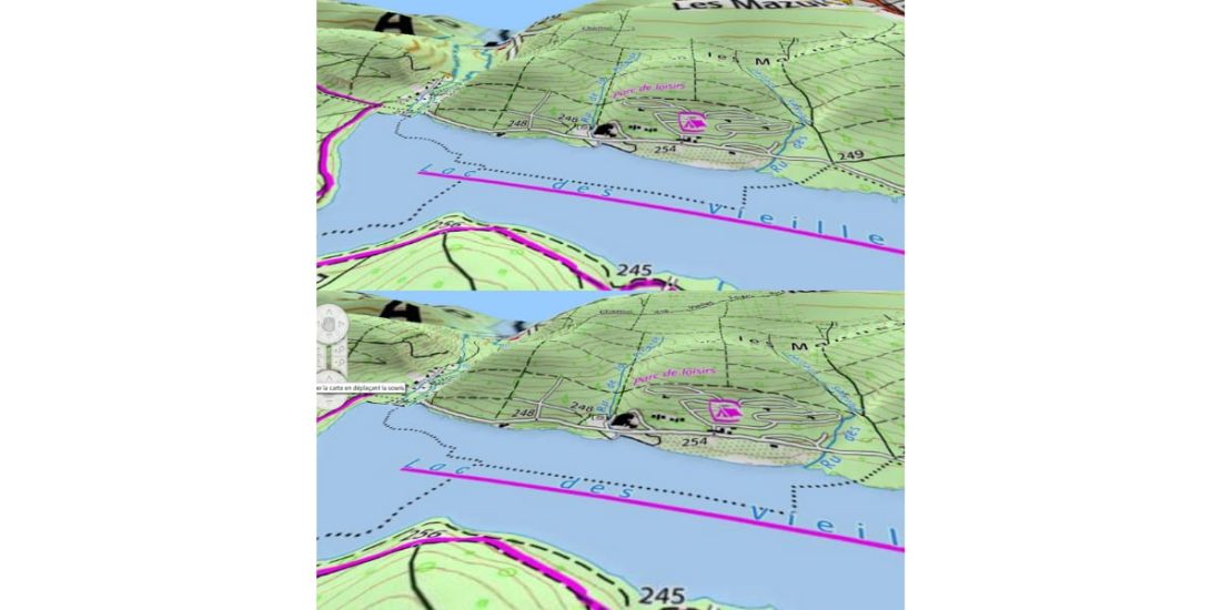
For the user, the correct test to assess the reliability of the “DEM” is the visualization of the lake surface in 3D.
Under the lake of the old forges (Ardennes), shown in 3D by BD Alti IGN above and BD Alti Sonny below. We see that there is quality.
The CDEM altimeter maps supplied by TwoNav as standard for their GPS or LAND software are not very reliable.
Thus, this "tutorial" provides a user guide for downloading "tiles" of reliable altimetry data for the TwoNav GPS and LAND software.
Data is available free of charge for:
- All Europe: Sonny Altimetry Database,
- France: IGN altimetry database.
You can create a file covering country, department, or geographic area only (Slab / tile / Pellet) to save usable memory or use smaller files.
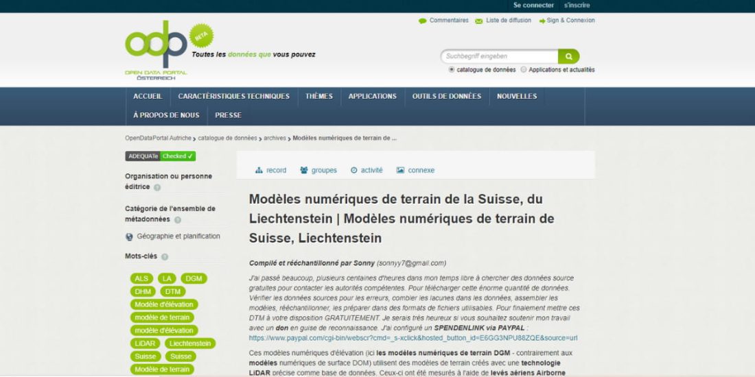
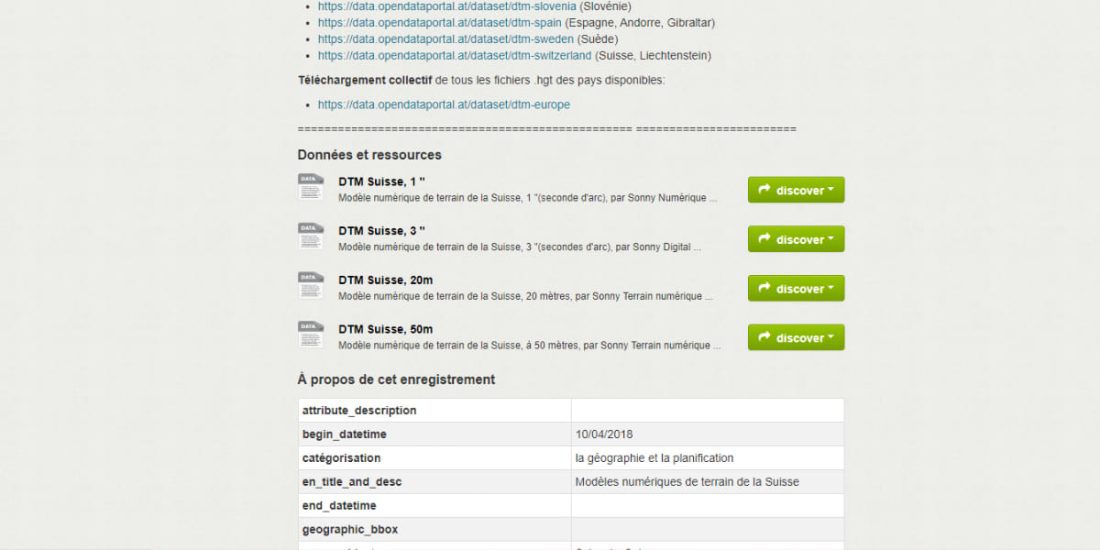
Sonny Altimeters Database
The 1 '' models are divided into 1 ° x1 ° file chunks and are available in SRTM (.hgt) format with a cell size of 22 × 31 m depending on latitude, a format used worldwide and used in many programs. They are designated by their coordinates, for example N43E004 (43 ° north latitude, 4 ° east longitude).
procedure
- Connect to the site https://data.opendataportal.at/dataset/dtm-france
- Download the tiles corresponding to the selected country or geographic sector.
Extract the .HGT files from the downloaded .ZIP files.
In LAND, load each .HGT file
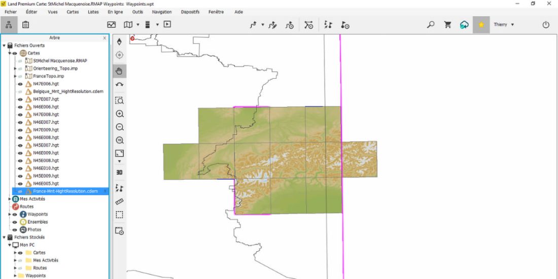
- In LAND, all the desired .hgts are open, close the rest.
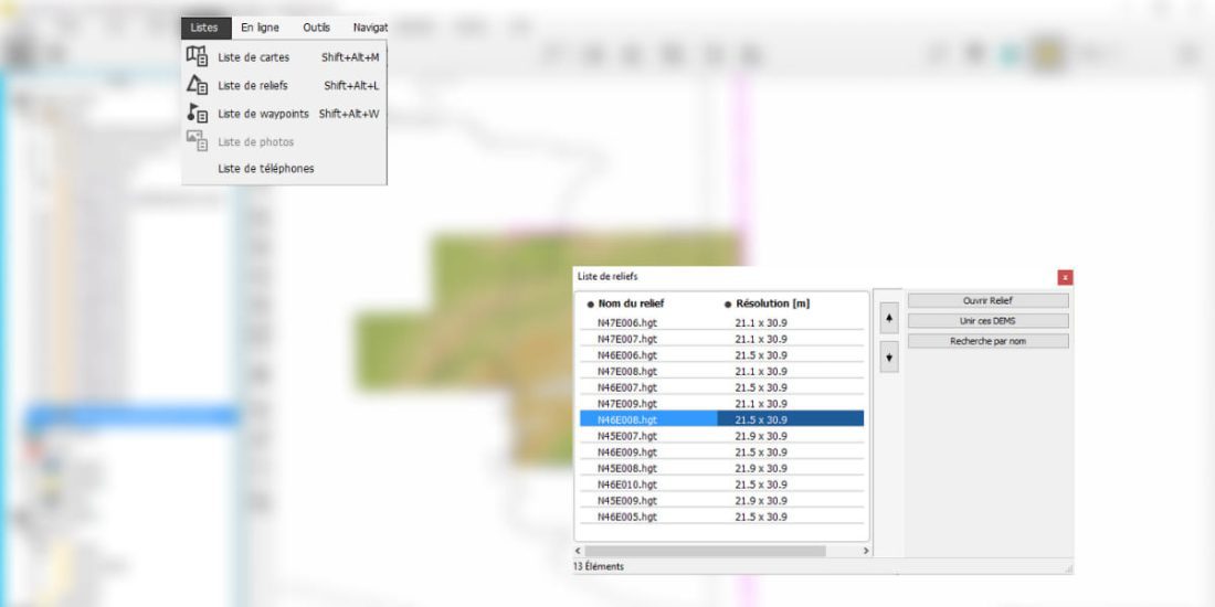
- Please do "Combine these DEMS", compilation time can be long depending on the number of tiles to collect (choose the cdem extension) for the .CDEM file that can be used on the Twonav GPS.
OSM "tile" and MNT "tile" mapping in LAND, everything is portable to GPS and 100% free!
IGN Altimetry Database
This database consists of a directory by department.
procedure
- Connect to Geoservices site. If this link doesn't work: your browser "doesn't have FTP access": don't panic! User guide:
- In your file manager:
- right click "this PC"
- right click "add network location"
- Enter the address "ftp: // RGE_ALTI_ext: Thae5eerohsei8ve@ftp3.ign.fr" "without" ";
- Name this access to identify it ex IGN geoservice
- End the process
- Wait a few minutes for the file list to update (it will take a few minutes)
- You now have access to IGN data:
- Right click on the data file you want to copy.
- Then INSERT into target directory
- Charging times can be long!
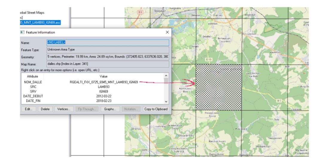
This image illustrates the import of the Vaucluse 5m x 5m altimeters database. Right click on the file, then copy to the folder and wait for the download.
After unpacking the “zipped” file, a tree structure is obtained. The data corresponds to about 400 data files (tiles) 5 km x 5 km or 1000 × 1000 cells 5 m x 5 m in .asc format (text format) for the department.
The multi-tile disc mainly covers the MTB track.
Each 5x5 km cell is identified by a set of Lambert coordinates 93.
The UTM coordinates of the upper left corner of this tile or tiles are x = 52 6940 and y = 5494 775:
- 775: column rank (770, 775, 780, ...) on the map
- 6940: Rank the line on the map
- Dance LAND
- In the next step, find the data in the "data" directory, select only the first file:
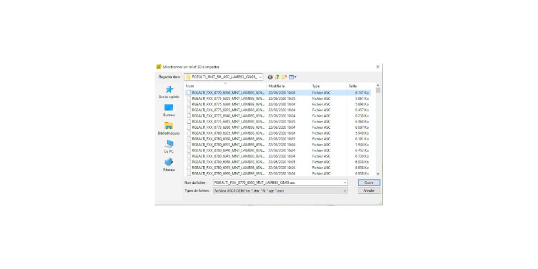
- Open then confirm, the below window will open, be careful, this is the most delicate step :
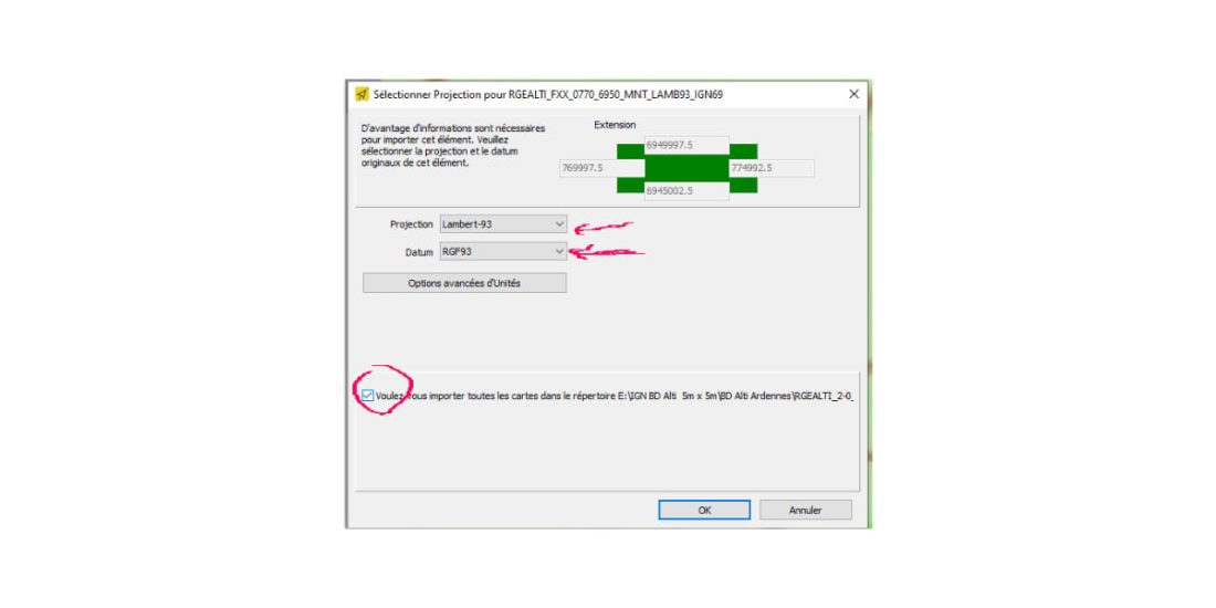
Select the projection Lambert-93 and Datum RGF 93 and check the box in the lower left corner.
Land extracts and formats data from * .asc tiles, which can take a while.
After creating slabs from DEM in SRTM (HGT / DEM) format, there are as many of them as there are files in * .asc format.
- Land allows you to "combine" them into a single DEM file or by tile or granule to suit your needs (keep in mind that file size can slow down GPS processing)
For ease of use, it is preferable (optional) to cover all open cards first.
In the map menu (see below) open all files in the * .hdr format (the least voluminous) of the imported database data directory (as for the previous operations)
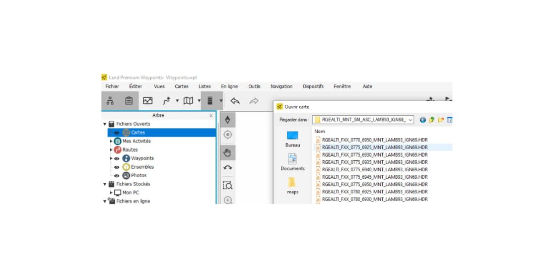
Land opens HDR files, department DEM is loaded and can be used
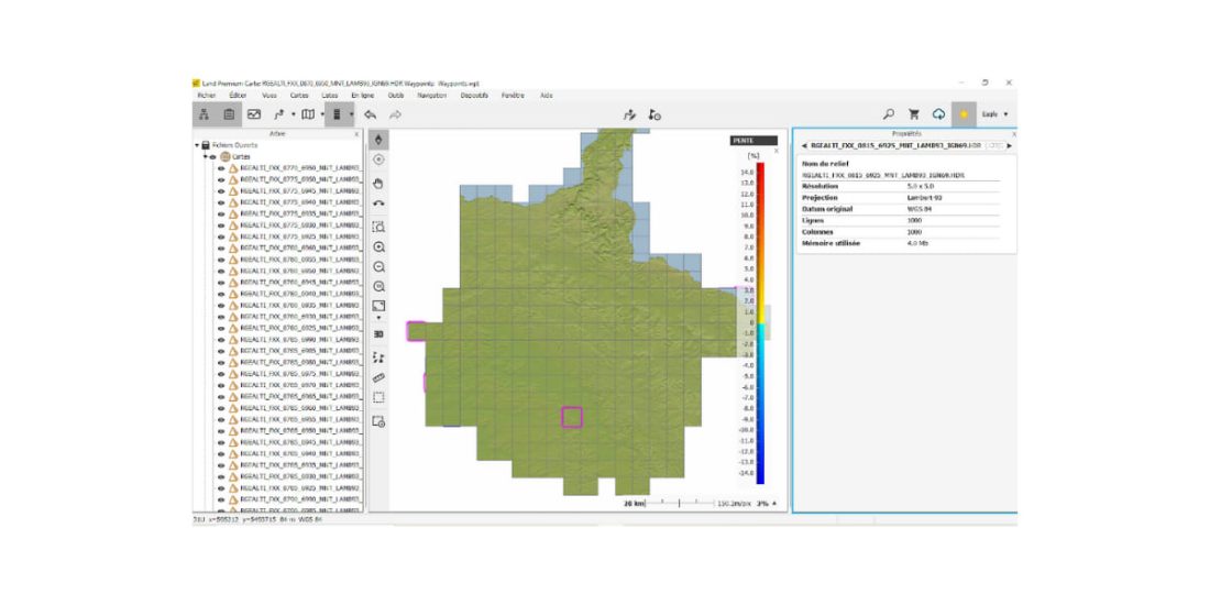
- Here you can use the Ardennes DEM (bump map), to make it easier to use, we will combine them into one file.
List menu:

Combine these DEMs
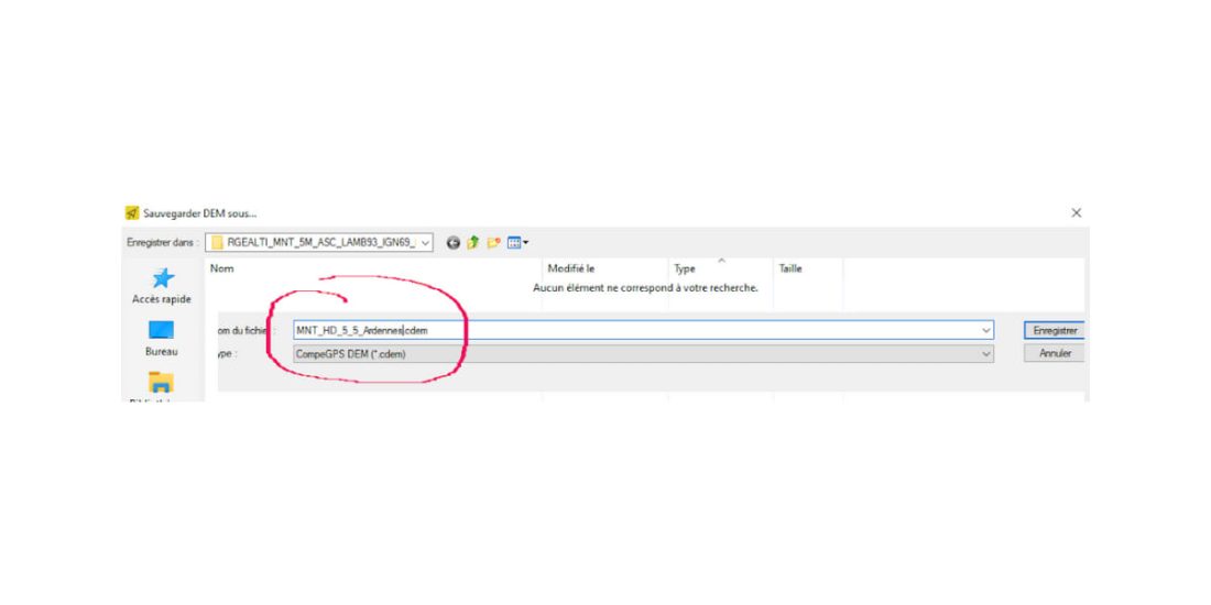
Select the * .cdem format and name the file DEM.
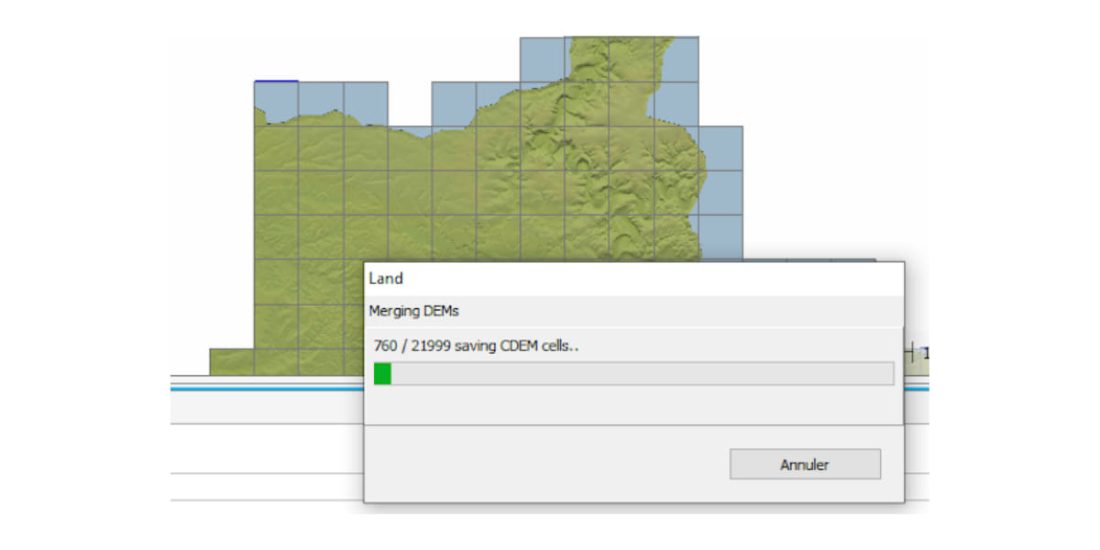
The merge will take a little time, more than 21 files need to be merged. Hence the recommendation to work on the basis of MNT granules covering your playgrounds.
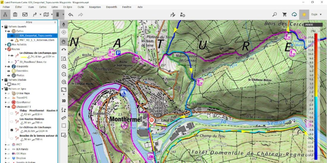
We created a digital model of the Ardennes terrain, just open this IGN Geoportal map file as shown below, for example.
The test is performed by directly opening the UtagawaVTT track “Château de Linchamp” displayed at the start at a height difference of 997m, 981m with Sonny DTM (previous process) and 1034m when Land replaces the height at each point with a DTM height of 5mx5m.
 Calculation of the level difference by summing the contour lines on the IGN map shows a difference in level of 1070 m, that is, a difference of 3%, which is quite correct.
The value of 1070 remains approximate because it is not trivial to calculate curves on a map in relief.
Using an altimetry file
MNT.cdem files can be used by LAND to extract elevation, calculate elevation, slope, waypoint tracks, and more; and for all TwoNav GPS devices it is enough to put the file in the / map directory and select it as map.cdem.
A blog article on inaccurate altitude reveals the problem of altimetry and altitude differences using GPS, the principle can be carried over to GPS watches as well as smartphone apps.
Manufacturers use several methods to “erase” the inaccuracies presented in this article, filtering (moving average) altitude data, using a barometric sensor or digital terrain model.
GPS altitude is “noisy”, i.e. fluctuates around an average value, barometric altitude depends on the vagaries of barometric pressure and temperature, so weather and DEM files can be inaccurate.
Hybridization of a barometer with GPS or DEM is based on the following principle:
- Over a long period of time, the change in barometric altitude depends on weather conditions (pressure and temperature),
- Over a long period of time, GPS altitude errors are filtered out,
- For a long time, DEM errors are similar to noise, so they are filtered out.
Hybridization is about calculating the average GPS or DEM altitude and extracting the altitude change from it.
For example, during the last 30 minutes, the height of the filtered noise (GPS or MNT) has increased by 100 m; however, over the same period, the altitude indicated by the barometer increased by 150 meters.
Logically, the change in height should be the same. Knowledge of the properties of these sensors makes it possible to "readjust" the -50 m barometer.
Typically in Baro + GPS or 3D mode, the barometer altitude is corrected, as a hiker or climber would manually, by referring to the IGN map.
Specifically, a recent GPS or a recent smartphone (good quality) detects you (FIX) with an accuracy of 3,5 m in the horizontal plane 90 times out of 100 when the reception conditions are ideal.
This horizontal “performance” corresponds to a mesh size of 5 mx 5 m or 25 mx 25 m and the use of these DTMs allows good vertical accuracy.
The DEM shows the height of the ground, for example if you cross the Tarn Valley on the Millau viaduct, the track recorded on the DEM should take you to the bottom of the valley, even if the path remains on the viaduct platform. ...
Another example, when you are mountain biking or traveling on a steep mountainside, the horizontal GPS accuracy deteriorates due to masking or multipath effects; then the height assigned to FIX will correspond to the height of an adjacent or more distant slab, hence either to the top or to the base of the valley.
In the case of a file formed by grids of a large surface, the height will tend to the average between the bottom of the valley and the top!
For these two extreme but typical examples, the cumulative difference in height will gradually deviate from the true value.
Recommended Use
To avoid side effects:
- Calibrate the GPS barometer at the altitude of your starting point shortly before departure (recommended by all GPS manufacturers),
- let your GPS do a few FIXES before starting tracking so that the positioning accuracy matches,
- select hybridization: altitude calculation = Barometer + GPS or Barometer + 3D.
If your track elevation has been synced to DEM, you will have very accurate elevation and slope calculations like in the image below, where the difference is only 1 meter.
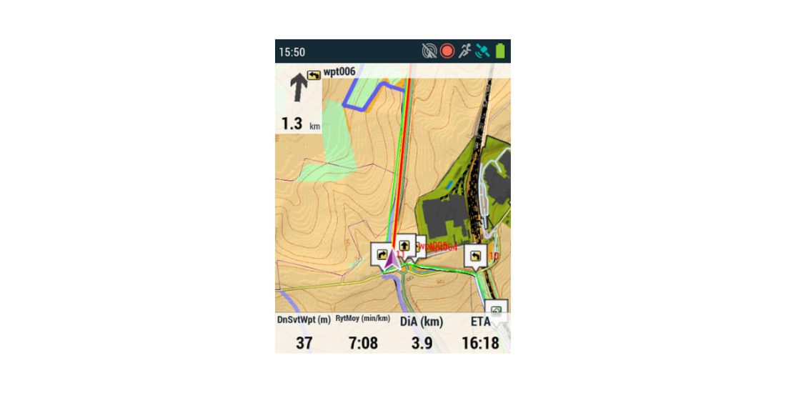
- GPS Trail 2 (72dpi degraded image capture, 200dpi GPS screen)
- Overlay raster and OSM vector map
- Scale 1: 10
- CDEM 5mx5m BD Alti IGN shading emphasizes the height in 1m increments.
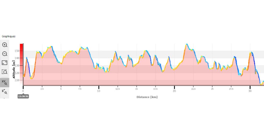
The image below compares the profile of two identical 30km tracks (of the same fame), the height of one was synced with IGN DEM and the other with Sonny DEM, a route run in baro + hybrid mode 3d.
- Altitude on IGN map: 275 m.
- Altitude calculated with GPS in Hybrid Baro + 3D mode: 295 m (+ 7%)
- Altitude calculated with GPS in Hybrid Baro + GPS mode: 297 m (+ 8%).
- Synchronized climb on IGN MNT: 271 m (-1,4%)
- Synchronized climb on Sonny MNT: 255 m (-7%)
"Truth" is probably outside of 275m IGN due to the curve setting.
Example of automatic calibration (compensation) of the GPS barometric altimeter during the route shown above (Original log file from GPS):
- No vertical accumulation for calculating the height difference: 5 m, (Parametrization is identical to the curves of the IGN map),
- Altitude during calibration / reset:
- GPS 113.7 m,
- Barometric altimeter 115.0 m,
- Height MNT 110.2 m (Carte IGN 110 m),
- Iteration (Settlement Period): 30 minutes
- Barometric correction for the next 30 minutes: – 0.001297