How to create an OpenStreetMap basemap for your GPS
Content
This guide provides you with a guide to creating an OpenSteetMap that can be used offline by Garmin or TwoNav GPS.
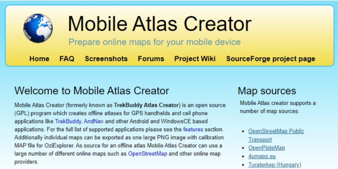
The first step is to install the MOBAC software.
Install Mobac
Mobile Atlas Creator allows you to create your own offline maps (Atlas) for a large number of (mobile) and GPS applications from the OpenStreetMap 4Umaps.eu cartographic database.
See some examples, a complete list on the site!
- Garmin Custom Map - KMZ (Handheld GPS Devices)
- TwoNav / CompeGPS
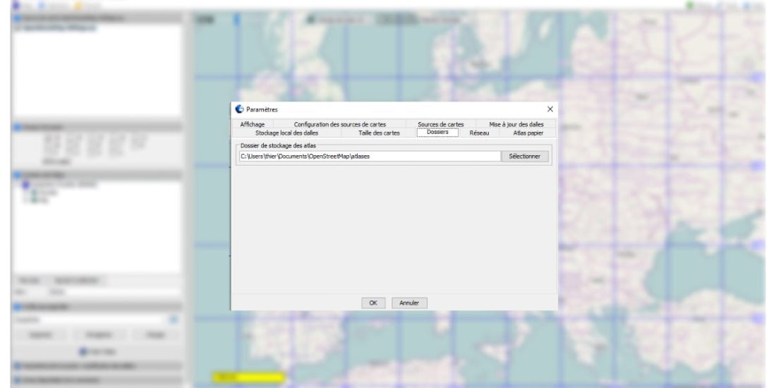
It is advisable to install Mobac in user / document / your directory because Mobac must have write access to the installation directory, or, depending on the rights granted by Windows in the C: programs, MOBAC may not be able to write its files.
Configure MOBAC
After installing MOBAC:
The map is moving right click down moving the mouse
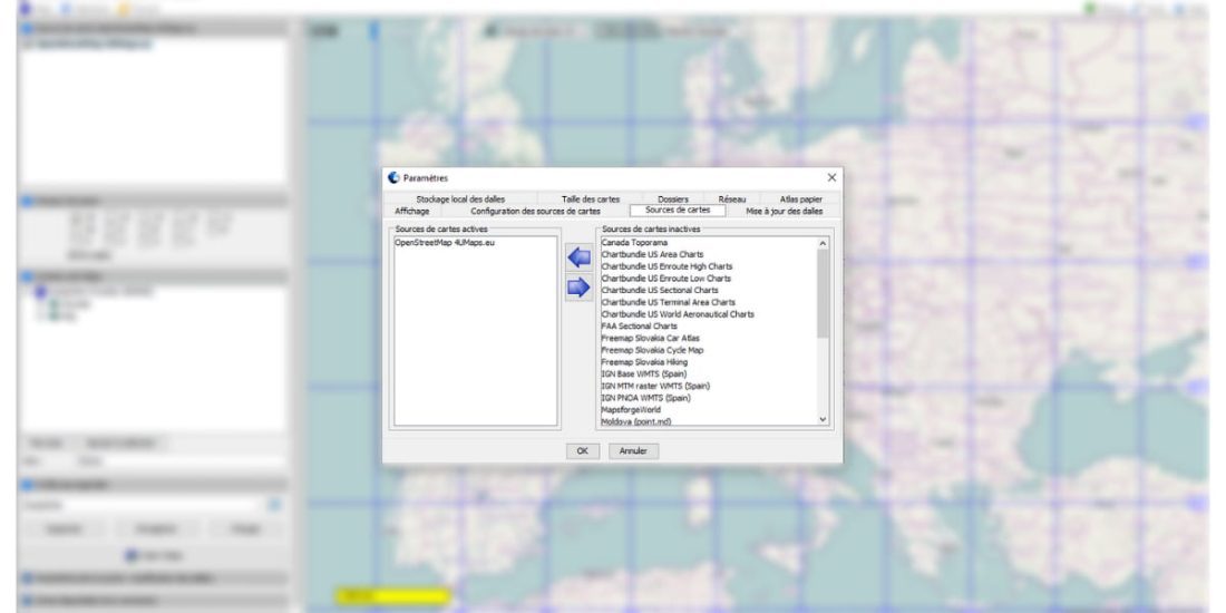
- Top right "TOOLS"
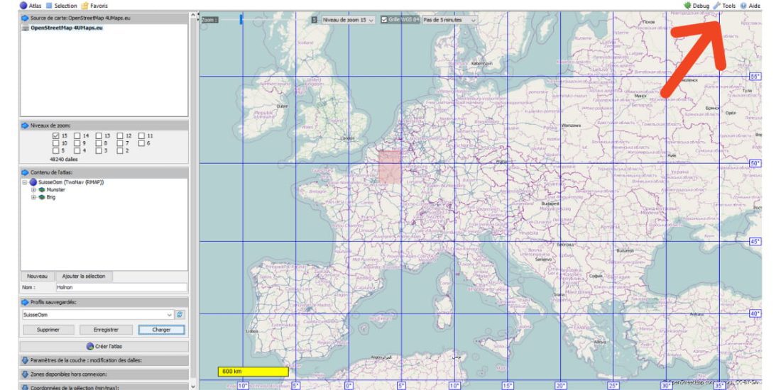
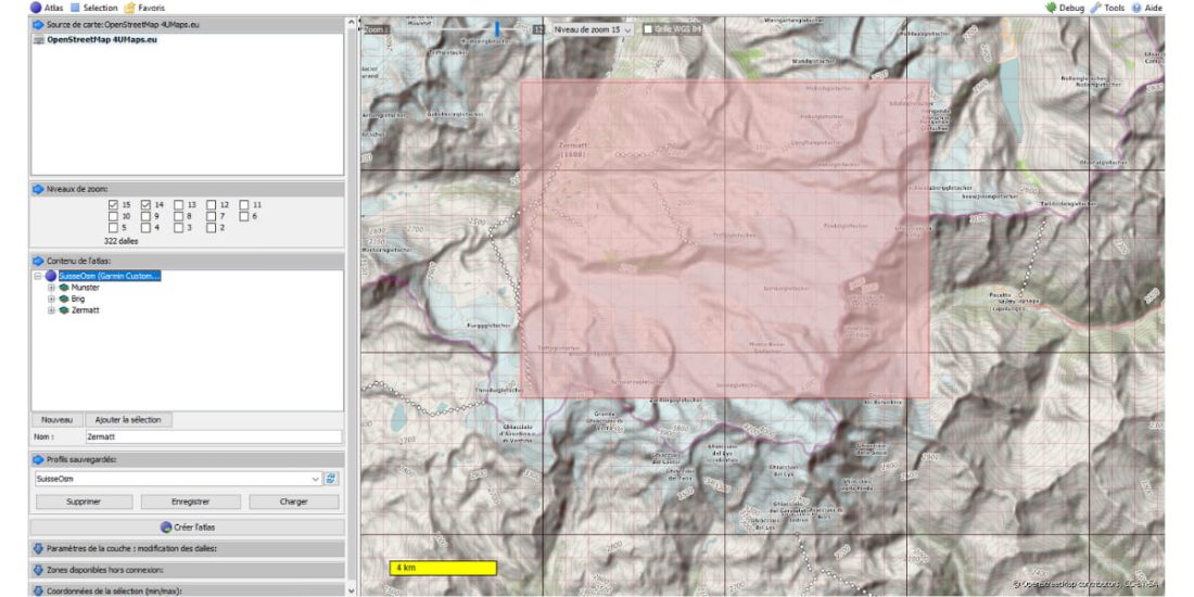
Select map source: OpenstreetMap 4Umaps.eu
Determine the path to the map storage folder: your path
Prepare your card
Top left menu: Atlas
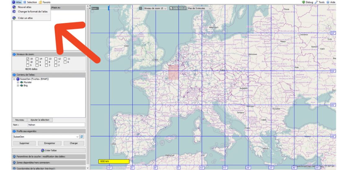
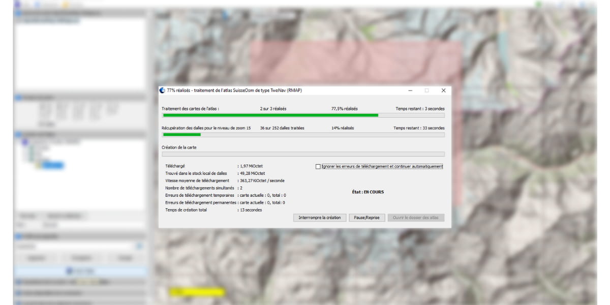
- Select format: For illustration we choose RMAP format for TwoNav GPS, you can choose kmz format for Garmin GPS.
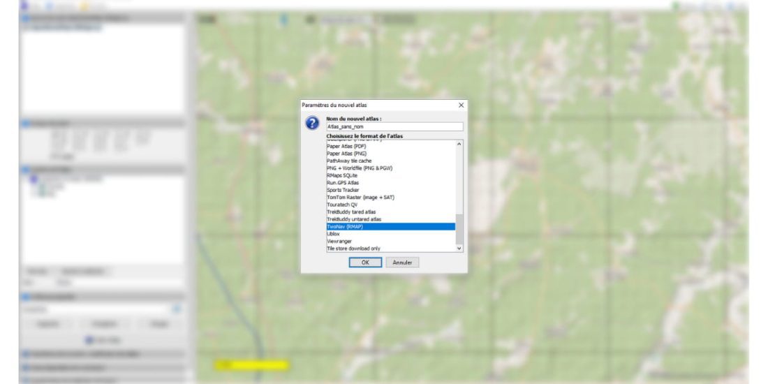
Name your Atlas: This will be SwissOsm for illustration purposes.
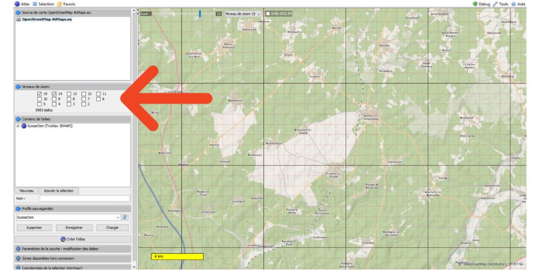
Select the zoom level:
The checkbox is checked in the left window and at the top of the screen.
15 is the value for getting the best contrast
Move / center the map on the area of interest.
The "Debug command" in the upper right corner allows you to display the boundaries of the slabs.
For Zermatt and Matterhorn we get this.
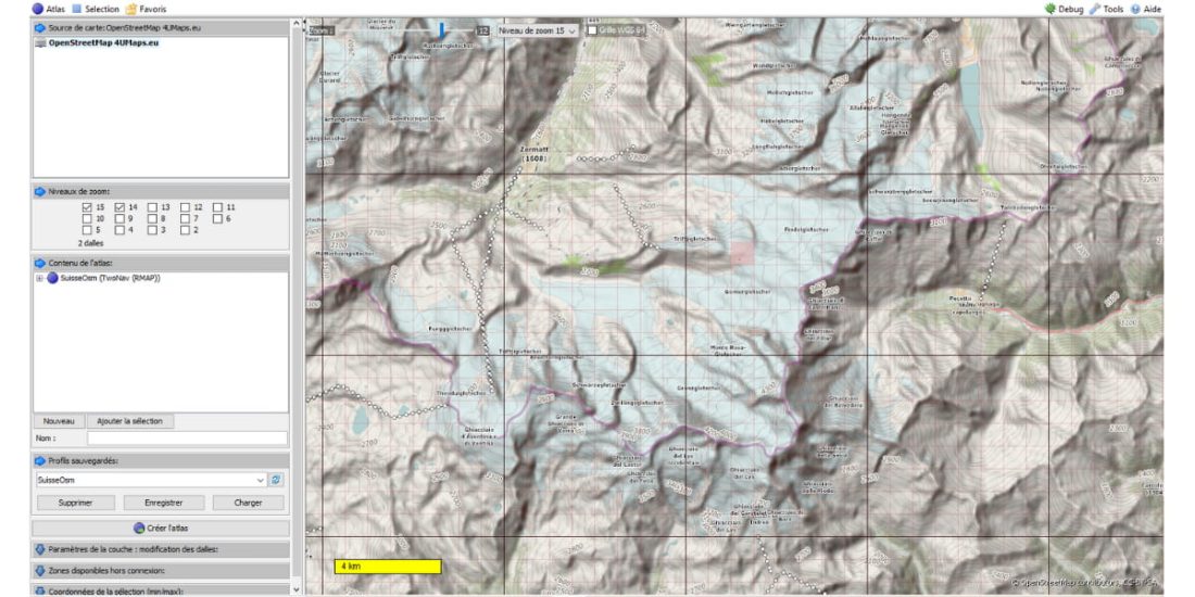
Left click on the area of the map you are looking for. You can load a file in gpx format using the "Tool" command and create a map in the center of the track.
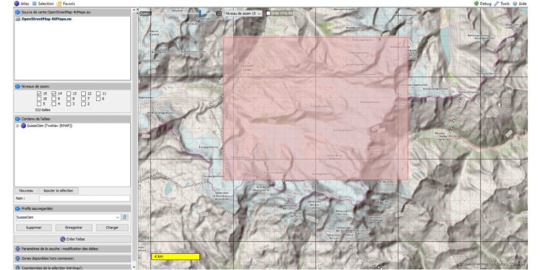
Left Window: Enter a name, then add to Atlas.
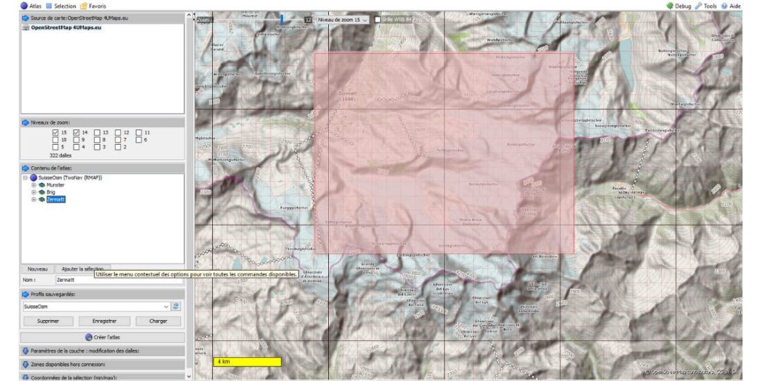
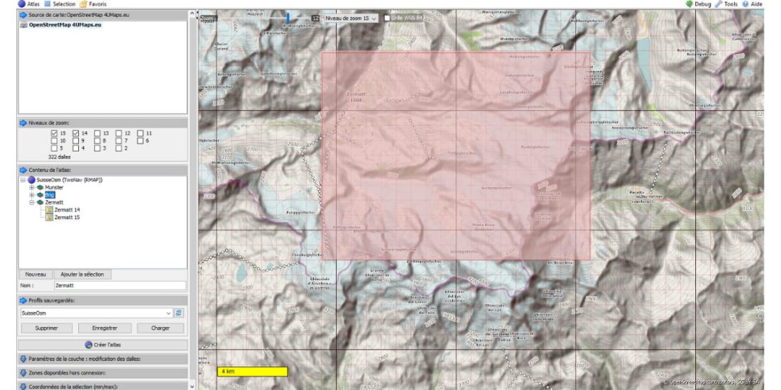
Do not forget to name and save your atlas so that you can restore it and enrich it later with new tiles. To illustrate, Mobac has created two zoom tiles 14 and 15, in which case you will have to remove the zoom bar 14.
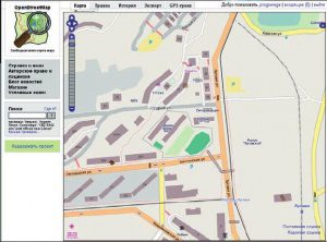
The illustration shows an OSM map of Switzerland with three tiles - Munster, Brig and Zermatt, two adjacent Munster and Brig - the other isolated. Almost everything is possible, we can only load the cartography of the tracks into the GPS or fill the memory with a map of the country.
Create an atlas for GPS
Save (save profile)
The maps (tiles in Rmap format) are then saved in the directory you specify.
Garmin
It's the same with the kmz format
Top left menu “change format ..”
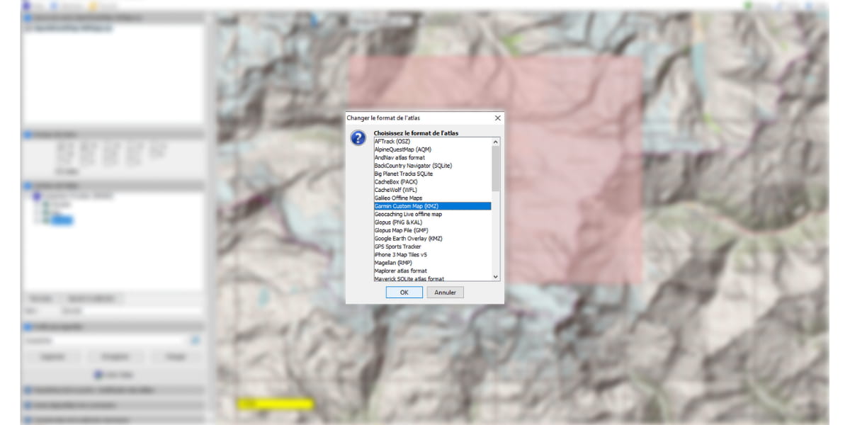
A little delay, then you click in another window to refresh the screen and the Garmin format appears, we save (Save Profile)
Our maps are available and placed in another subdirectory.
Preparing to switch to GPS
Rmap map can be loaded directly into the Land maps catalog or from GPS, through the file manager or through the context menu of Land maps for transfer to GPS: "Send to GPS".
The Land software allows TwoNav GPS devices to collect tiles or tiles, which allows the user to select only one file (like SwissOsmTopo.imp), then the GPS automatically opens the tiles or tiles.
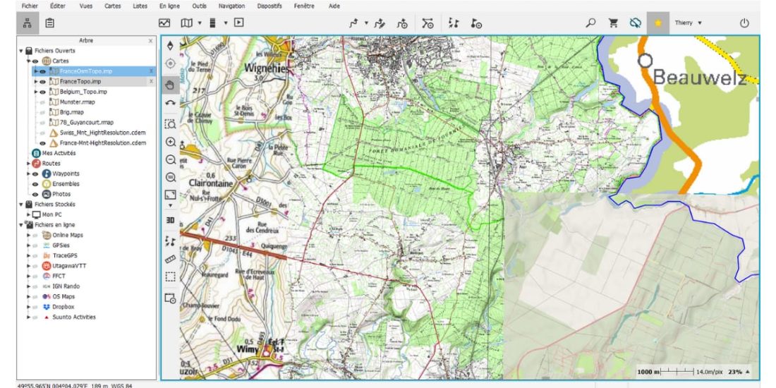
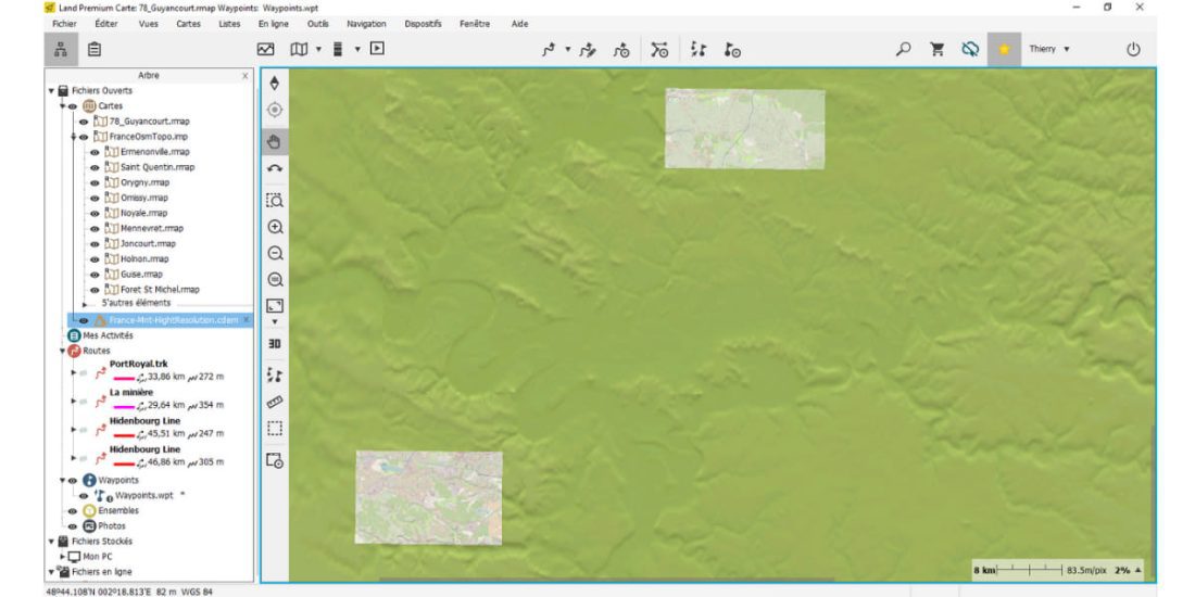
Illustration of LAND software on multiple maps (similar operation for TwoNav GPS), lower right corner, our OSM map, center IGN map 1/25000, left 1/100 France and upper right Belgium.
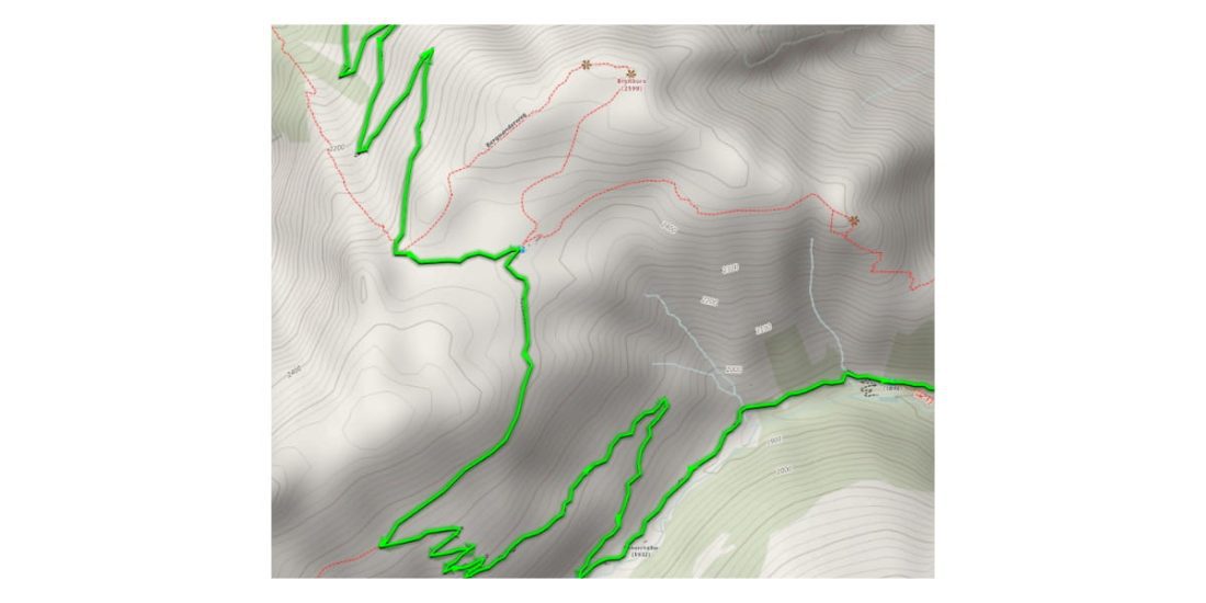
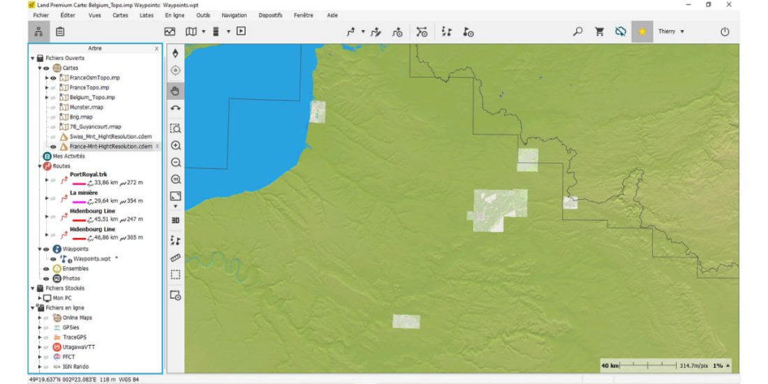
The image below shows one map consisting of scattered fragments centered at traces.gpx imported from UtagawaVTT (Le Touquet, Versailles, Hison, Mormal) and a series of adjacent fragments located north of St. Quentin, map with IGN background disabled ...
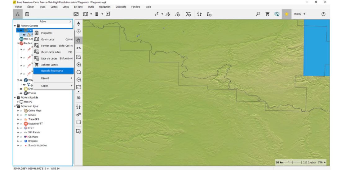
In Land: Map Data Tree / New Hyper Map
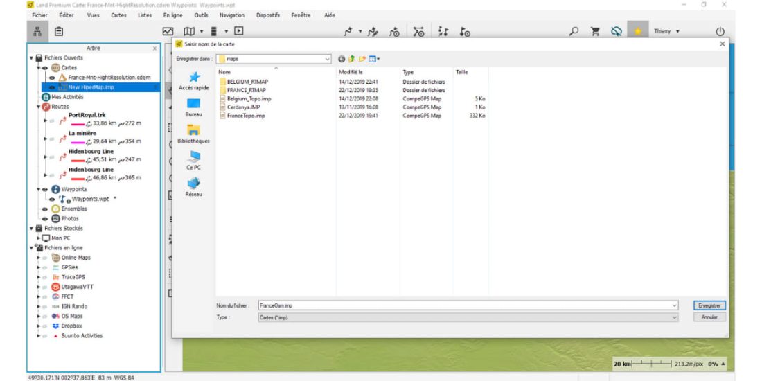
Create and save this new HyperMap in the / maps folder and rename it (FranceOsmTopo.imp example). with the extension ".imp".
To facilitate onward transmission to your GPS and especially portability, move all the Rmaps you want to build from the directory created by MOBAC to a subdirectory under the root.../maps from the CompeGPS catalog
- example _CompeGps / maps / openstreetRTMAP / FranceOsm
Then in Land, you open each of these Rmaps in a data tree. card / face up card
Bathroom drag each rmaps to xxxTopo.imp with the mouse, for illustration below there is only one rmap file that can be inserted into the file “FranceOsmTopo.imp”
This is done and saved:
To view your maps in Land later, just open the file FranceOsmTopo.imp how are you doing with FrancetTopo.imp.
To complete the mapping, just create a new rmaps and drag it в “xxxOsmTopo.imp”.
Switch to GPS
With your favorite file manager:
- Copy file xxxxOsmTopo.imp в … / You map the GPS
- Copy the subdirectory containing "rmaps" to … / Maps from GPS for our illustration we copy ... /OpenStreet_RTMAP/ which updates all OSM Rmaps
For Garmin
For Garmin, simply copy each .kmz map from your GPS to the BaseCamp app, see this Garmin link