Testing apps… Navigating without Google
It's time to test mobile applications that will help us in the field - offline maps, navigation, satellite positioning, bike and walking paths.
Routes and Maps ViewRanger
The application allows you to plan a walking or cycling trip - in the mountains, through the forest or through the fields. It offers free maps, including specialized versions, as well as paid, more detailed versions.
We are surprised by the large number of bike paths and interesting rides that are perfect for the weekend. A weighty recommendation for the application is the fact that about two hundred search and rescue teams have already used it. Works with Android Wear smartwatches.
The program also offers social elements. It allows you to register your own expeditions and share them with other users. There are also routes recommended by famous travelers and travel magazines. In total, 150 XNUMX can be found in the application. routes recommended all over the world.
Maps.me
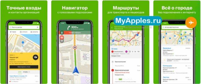
The maps and navigation developed by the Russians in the Maps.me application does not require the Internet to work. Working in a way that makes them different from Google is a big advantage for many. To use Maps.me maps, we only need to download the given areas to the device's memory. If we do not do this and start scaling the map in some area, then after a certain moment - when it is required to download detailed data about a given location - a message will appear asking you to download a package of maps for this country.
The app is based on maps from the OpenStreetMap project. Their creators are online communities that function similarly to Wikipedia. Thus, each of the registered users can add and edit the information contained in it.
OSM maps, and therefore the maps used in the Maps.me app, are recommended for use, among other things. for accurate mapping of terrain and streets. Dirt roads and forest trails are shown in detail, which is especially useful for hiking in the field.
OsmAnd
OsmAnd was developed for Android - it is used for GPS navigation and is based on OpenStreetMap data. It combines many features. It works in mode, but a recent update also allows you to use it, as well as support for additional layers.
On the classic OsmAnd map layer, we can overlay a bike map, Wikimapa, and even Microsoft satellite imagery. The data in the application is updated every two weeks. You can also search for addresses, tourist attractions, etc.
An interesting fact is that the application supports voice messages - they work well even in Polish, however, only after installing the Ivona speech synthesizer. Here you can activate different navigation profiles (car, bicycle, walking). The user also has the option to report a map bug on the OpenStreetBugs site directly from the app.
Geoportal Mobile
This is the official application of the state project Geoportal.gov.pl. It contains detailed satellite maps of Poland, comparable to or, according to some, even better than Google Maps satellite maps. It supports scanning old and extremely accurate topographic maps at 1:25 and 000:1 scales.
It is equipped with a terrain modeling function, which, in combination with topographic maps, gives interesting results. In other words, we can recreate a visual terrain in 3D on a phone and overlay a translucent topographic map over it.
The geoportal and its application also provide us with information on precise administrative boundaries and geographical names. This option can be useful, for example, to find out in which commune the specified piece of terrain is located. Unfortunately, the application does not have a mode and does not allow you to save maps or their fragments.
Latitude Longitude
This application allows you to share your position on the map i.e. latitude and longitude. For this, GPS is used, although satellite positioning can be dispensed with - of course, with less accuracy. You can share your current location with another person, you can also search and find it, and coordinate each other's movements, for example, to get to a point set on the map together, for example.
The most obvious use of this application is to find people, roads or destinations. Other uses include, for example, a selection of interesting outdoor games, treasure hunting, tracking, orienteering, etc.
The app allows you to share your coordinates in a variety of ways - via email and social networks such as Google+, Facebook, Twitter, Skype and SMS. You can also copy your own position to other mobile applications, programs and websites.
